CONSTRUCTION OVERVIEW
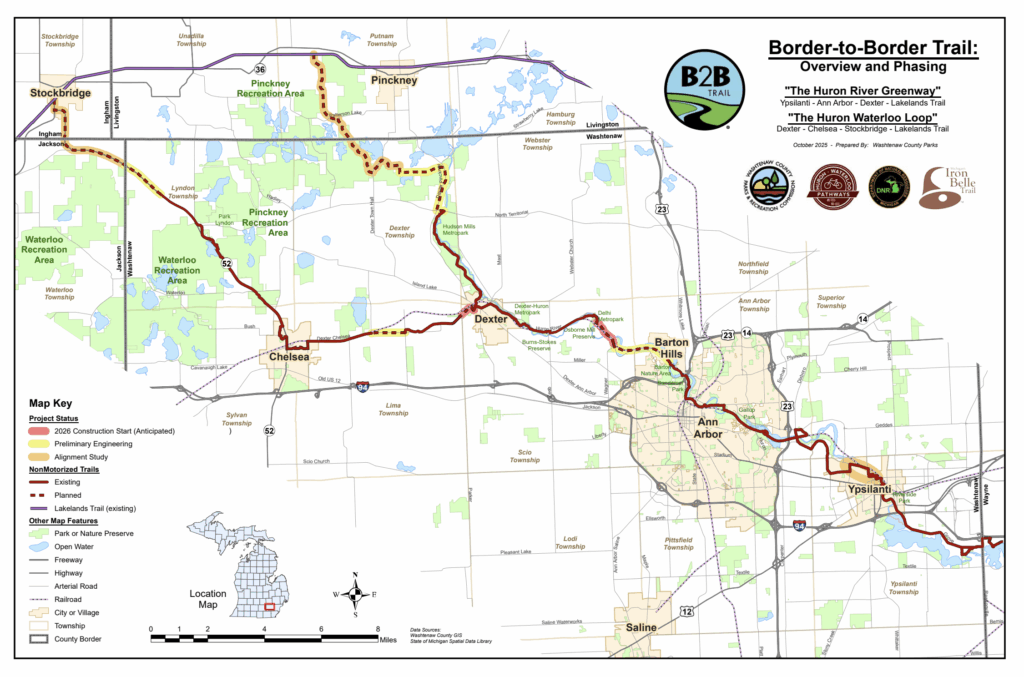
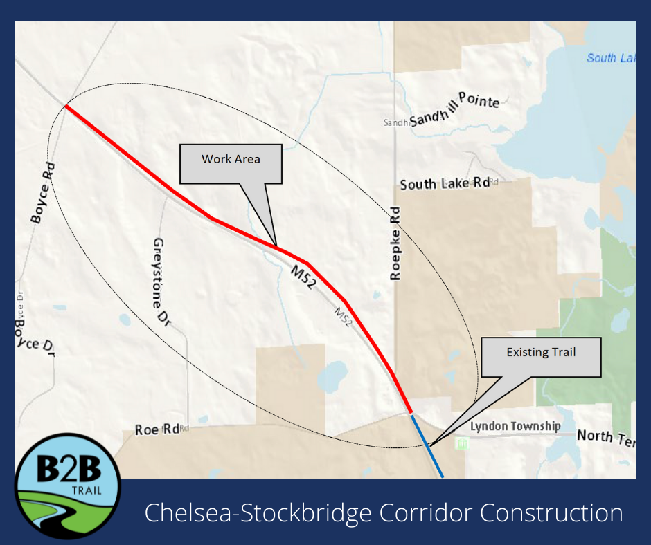
CHELSEA-STOCKBRIDGE CORRIDOR
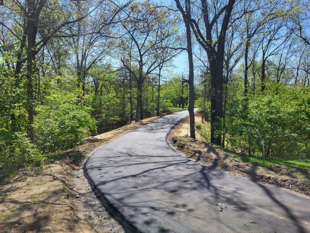
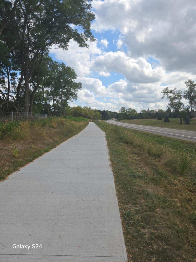
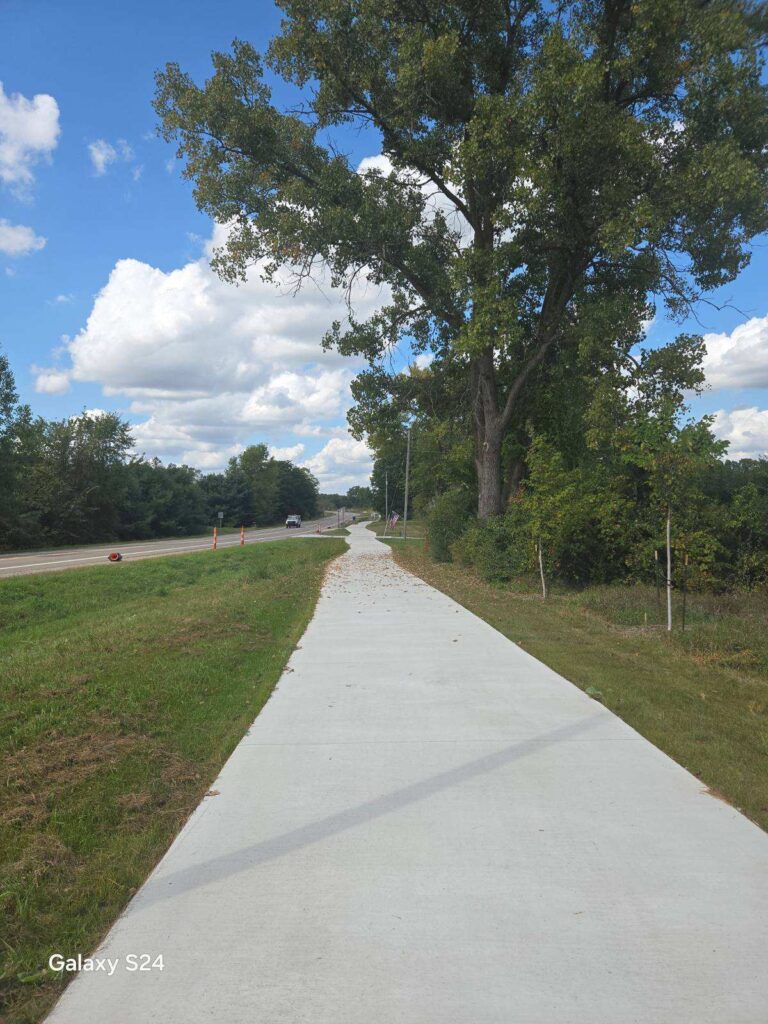
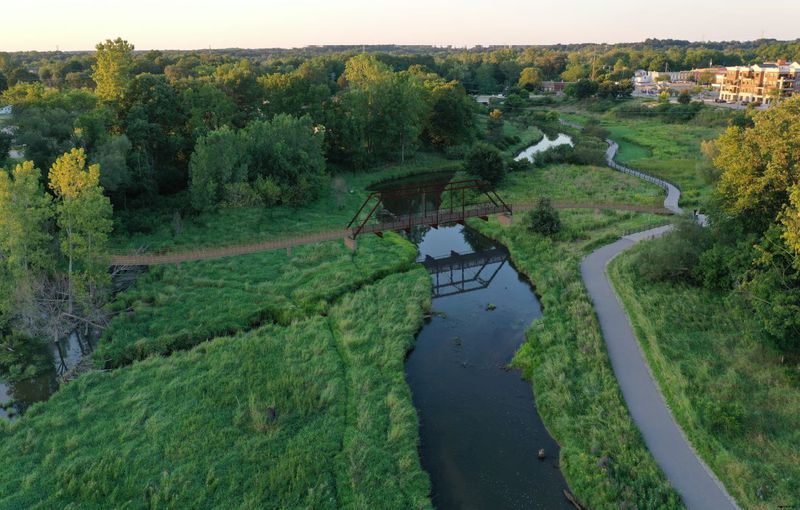
M52 Toward Stockbridge
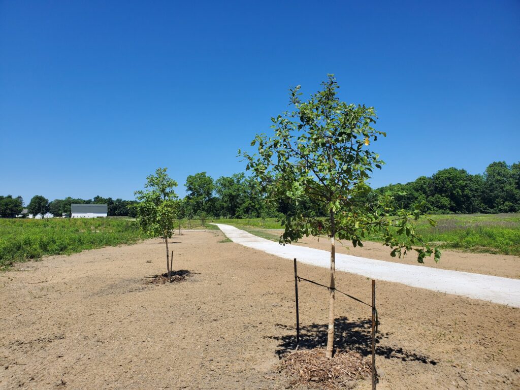
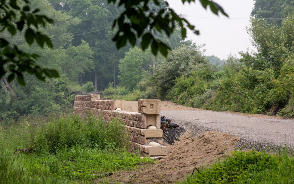
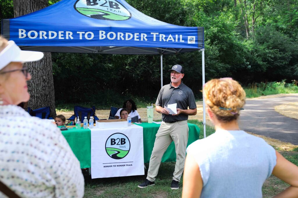
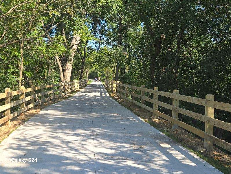
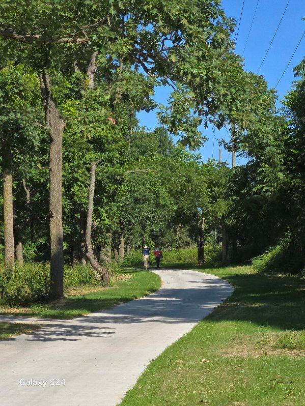
Construction began in 2023 on a new trail segment along the east side of M-52 in Lyndon Township and is complete as of fall 2024, with an official ribbon-cutting at the Tetens Trailhead in May 2025. This segment adds 1.6 miles, north of N. Territorial road to Boyce Road to create 7.9 miles of continuous trail starting in Chelsea in Timbertown. This project included grading, paving the trail, planting 106 native trees (maple, oak, lindens) and landscape restoration. This project also included pavement and fence repairs to the existing trail south of the trailhead near the DTE Trail connection.
In March 2024, a new 108ft concrete boardwalk was installed by the WCPARC team. This material is a new application on the B2B Trail, with great benefits such as being more cost effective, lasting 3x longer than a wooden boardwalk, and safer during rain events by creating a less icy and slippery surface.
We are looking forward to this trail segment bringing us closer to the western Washtenaw County border!
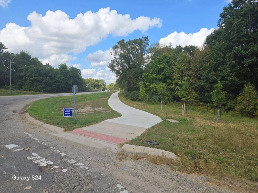
Chelsea Connection
The current route follows existing city streets and sidewalks through the City of Chelsea between Timbertown and Freer Rd., with wayfinding signs to be installed soon to delineate the route. A long term route is being coordinated in collaboration with the City of Chelsea’s nonmotorized planning efforts.
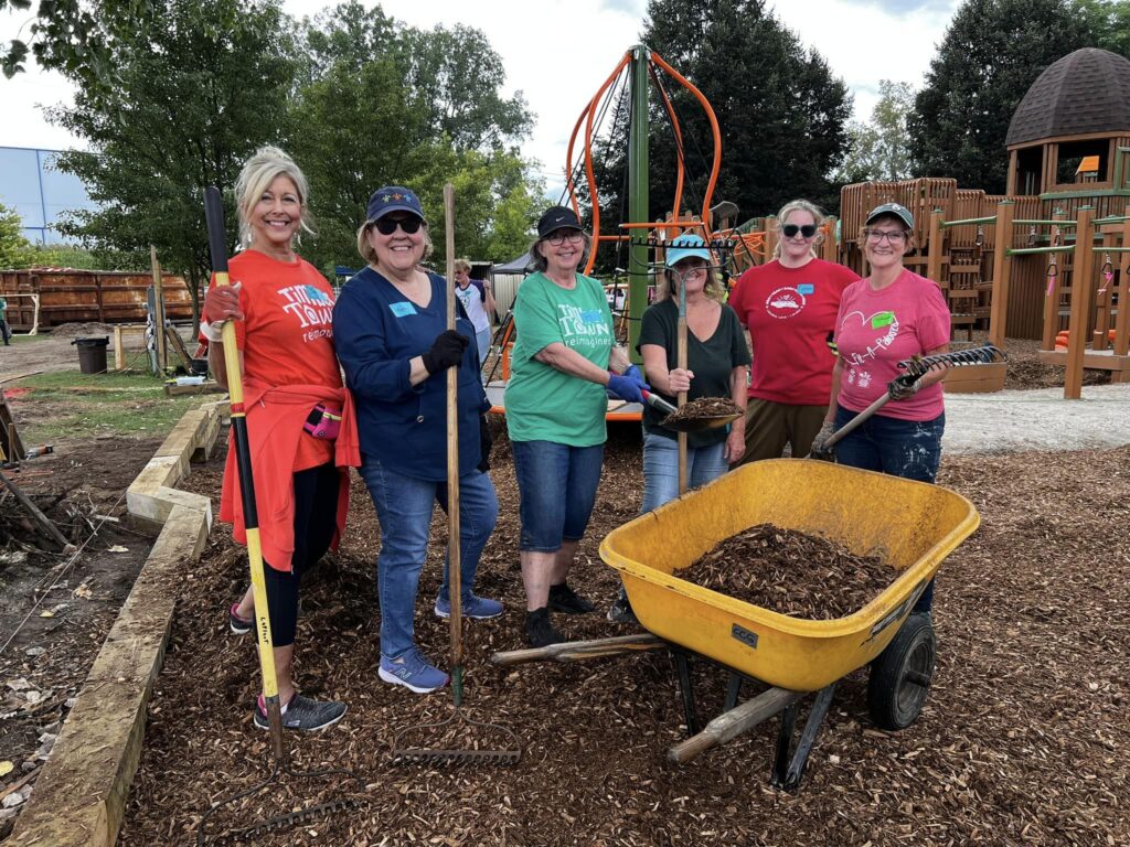
Timbertown Trailhead
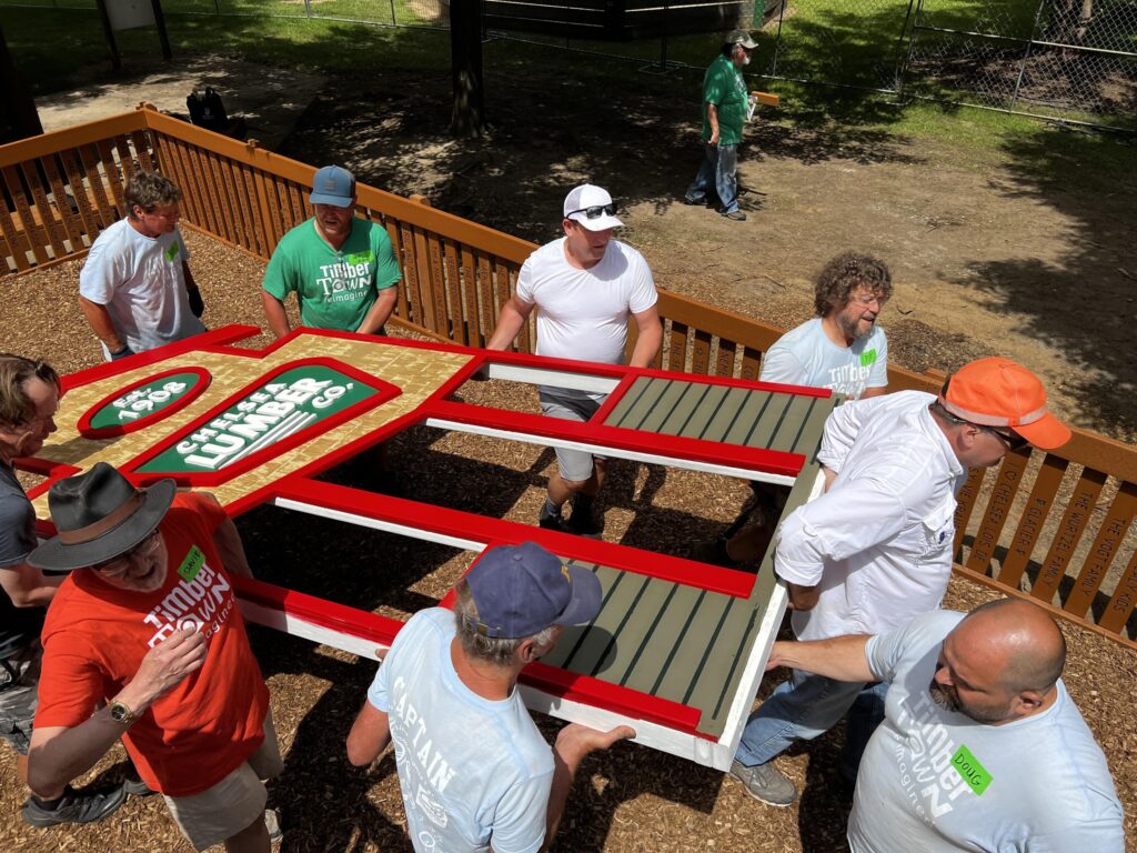
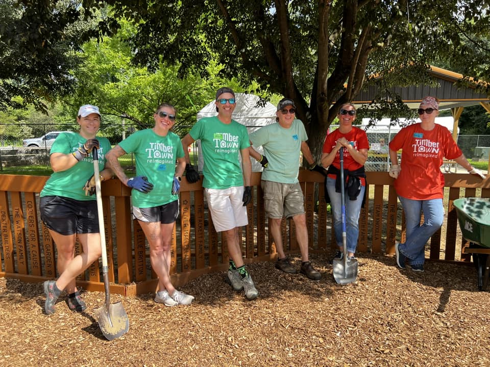
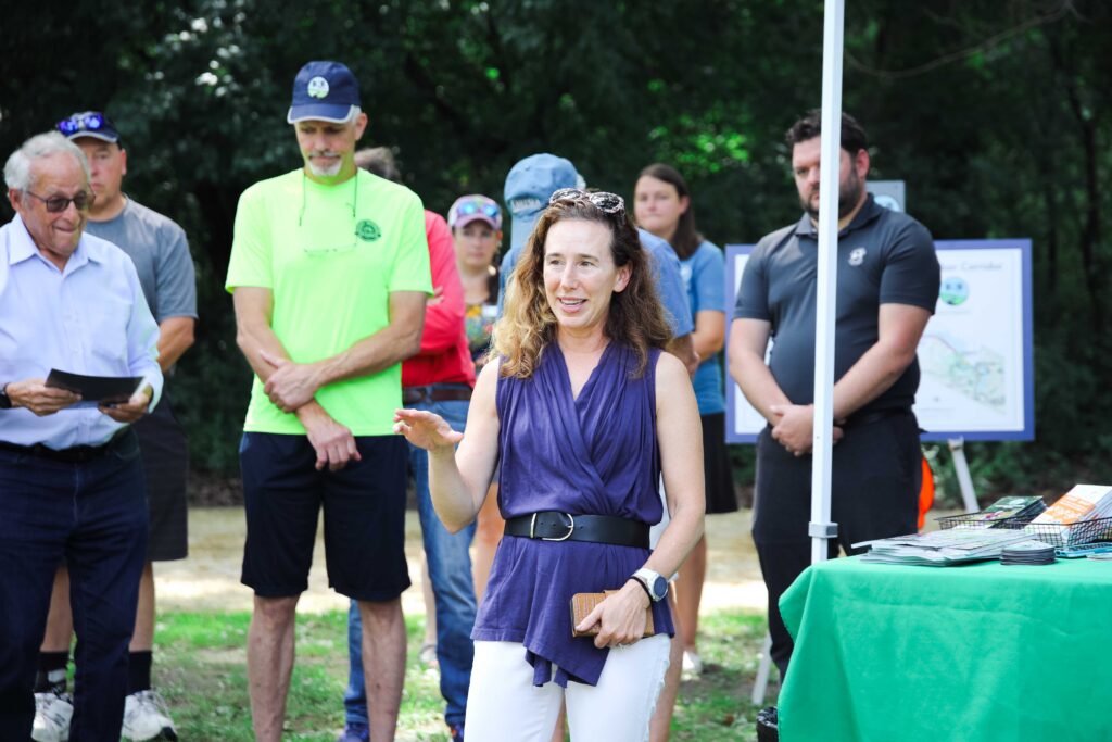
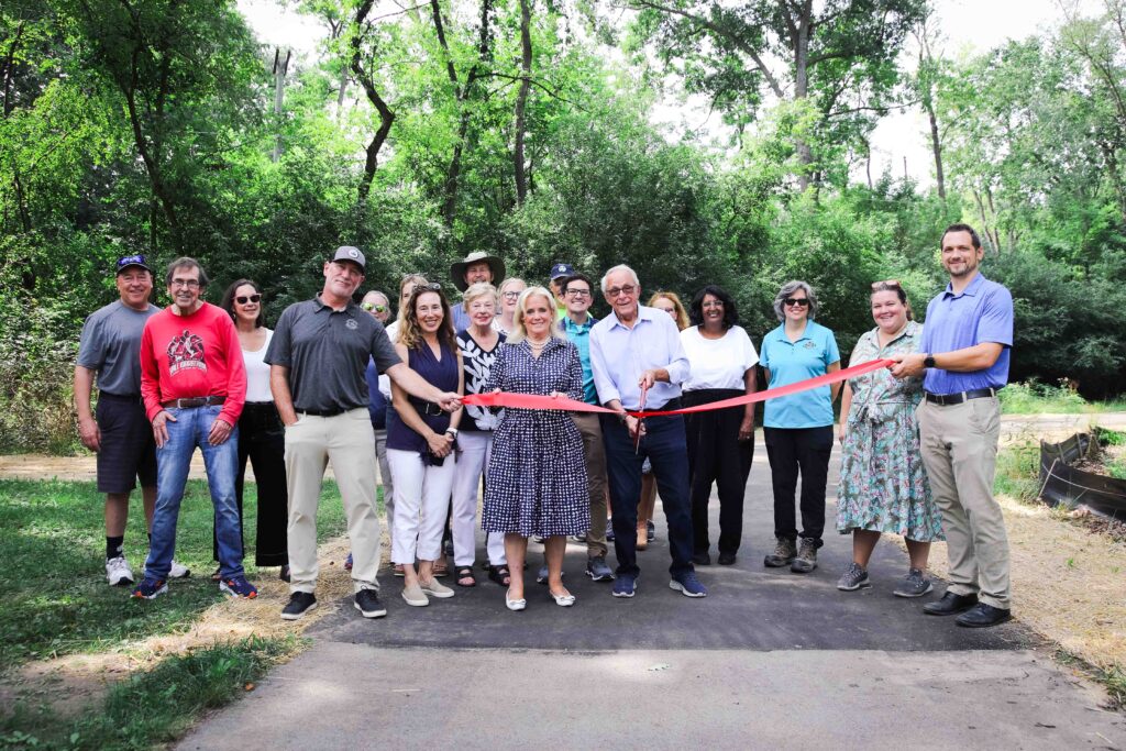
October 2025- The Timbertown Trailhead is now OPEN! After a tremendous community effort, both the trail and trailhead have been upgraded, along with the playground, art installation, and pickleball courts.
on September 30, 2025, members from HWPI, WCPARC, and the City of Chelsea hosted a dedication ceremony of this trailhead to Joel Gentz, a soldier killed in action along with four other airmen in Afghanistan.
Chelsea Councilman and Parks Commission Liaison George Merkel submitted Gentz’ name for this recognition. “Naming the trailhead for Capt. Joel C. Gentz honors his legacy as a Chelsea resident who gave their life in service to our town, state, and country,” added Merkel.
WCPARC and HWPI has a long history of partnering with the City of Chelsea to create some of the longest continuous stretches of B2B Trail. Both groups also worked with the Timbertown Reimagined project and the City during their planning and design process to ensure that the new park features and trailhead amenities were well coordinated.
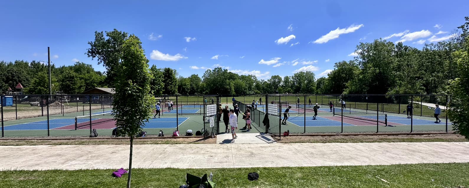
As part of the naming of TimberTown as an official B2B Trailhead, 4 projects — independent, yet with each bringing an important and complementary vision — are at the core of ‘Reimagined TimberTown’ effort. Six new pickleball courts opened in June and the wooden play structure complex received much-needed repairs and enhancements, which were funded by private donations earmarked specifically for these initiatives.
Contractors began in fall 2024 on building a parking lot, planting native trees, and installing one of the primary orientation nodes per the B2B Trail wayfinding plan. Completion is anticipated for summer 2025.
DEXTER-CHELSEA CORRIDOR
Border to Border Trail in Dexter Closing for Repairs
(Ann Arbor, MI) A stretch of the Border to Border Trail (B2B Trail) in Dexter will be closed starting Monday, April 20, 2026, through mid-June 2026 for necessary repairs. The segment, located in Dexter-Huron Metropark, includes replacing timber deck boards on six boardwalks due to wood rot and decay. The work will require complete closure of the trail between the park and Central Street in Dexter. This short-term closure and repair will ensure the public has a safe and scenic trail into the foreseeable future.
This project will be coordinated by Huron Clinton Metropark Authority (HCMA) and Washtenaw County Parks and Recreation Commission (WCPARC). HCMA and WCPARC will have signs in the restricted area throughout the project and post updates as construction progress occurs. Project status will also be posted on B2B Trail social channels.
Dexter-Chelsea Road
The remaining 0.7 miles from Wylie Road past Parker Road was completed in August 2024. This project included the installation of a short bridge to cross a small creek west of the Miller-Smith Preserve. Construction of 1,000 ft of trail now connects the B2B Trail from Dancer Road to Miller Smith Preserve. Per WCPARC rules, no bicycles are allowed in the preserve. So please leave your bike in the bike rack!
Downtown Dexter
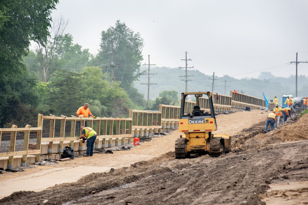
Construction continues to make steady progress on the Dexter Connection segment of the Border to Border (B2B) Trail.
To facilitate ongoing work, the contractor has closed the boardwalk on the City of Dexter side of the project. Posted detours are available for pedestrians and cyclists to maintain access to the Mill Creek Trail system during construction.
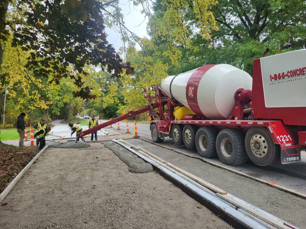
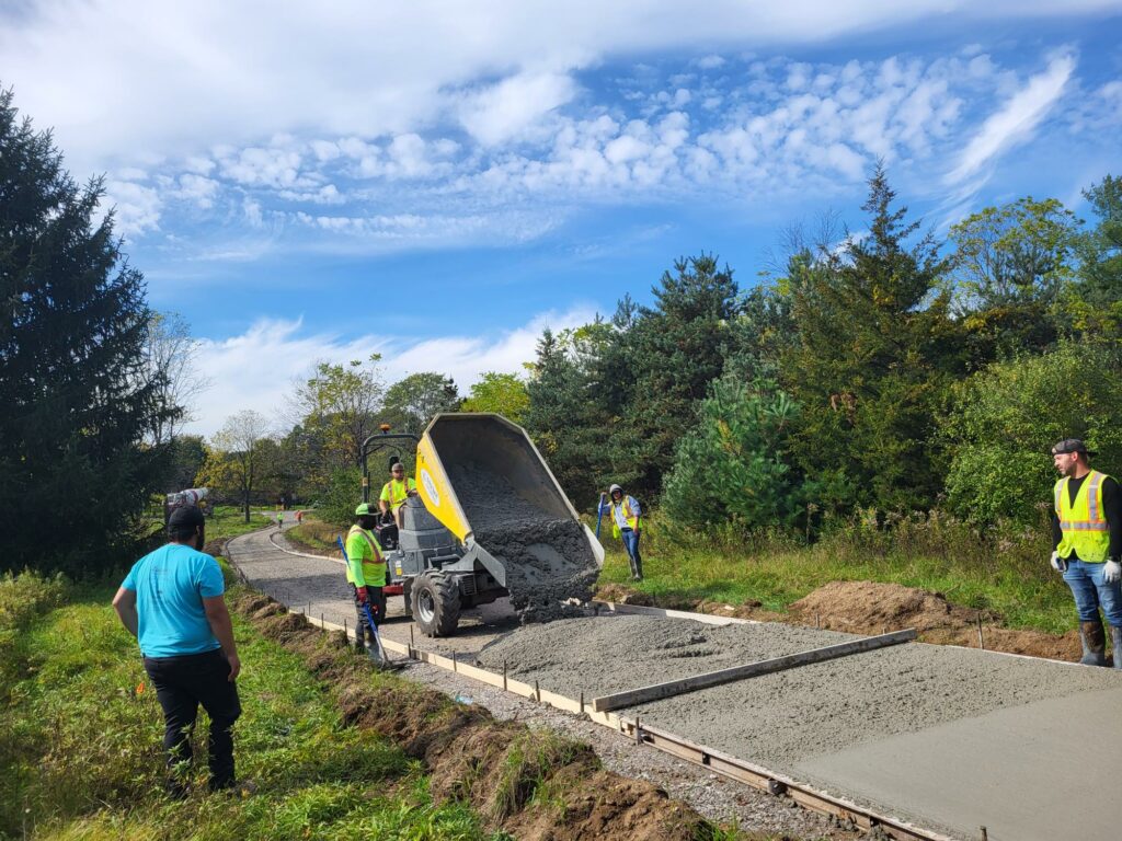
Crews are currently focused on trail grading along Dexter-Chelsea Road and have completed approximately 30% of the stone base installation in this section. Work will continue over the coming weeks as the trail corridor is prepared for concrete paving, which is anticipated to begin in early July.
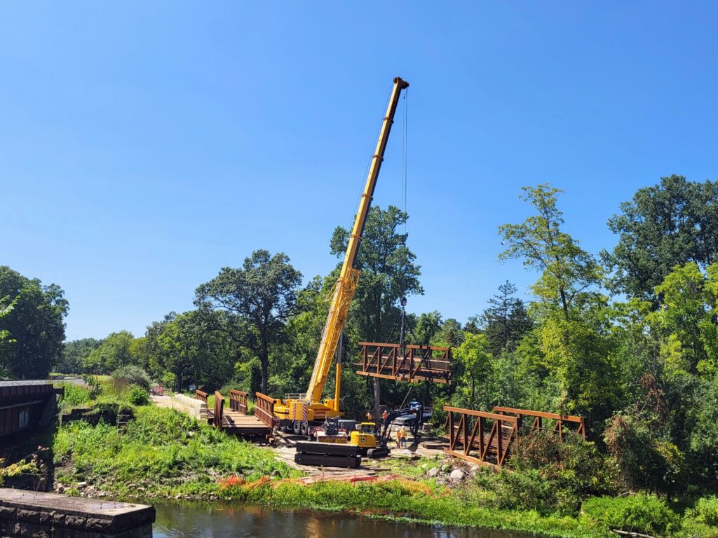
Additional project milestones are approaching. A crane is expected to be delivered to the Dexter side of the project within the next few weeks, allowing crews to begin installing the steel piling and pier caps that will support the new trail bridge crossing.
The historic Bell Road Bridge is also scheduled to arrive on-site in sections within the next few weeks. Once delivered, the bridge components will be reassembled as part of this exciting project, preserving a historic community asset while creating a key connection in the Border to Border Trail network.
As we work toward making the final connections between Dexter and Chelsea, parking will be challenging along this segment. Once the corridor is complete, there will be parking and safe public access. Until then, if you do park in this area, please do not use Beacon Hill Drive as it is a private road.
HUDSON MILLS METROPARK CORRIDOR
The Huron Clinton Metroparks have completed a study that seeks to connect all of the Metroparks via nonmotorized trails. Washtenaw County Parks, Metroparks, and others are using that study to lay the groundwork for future B2B Trail expansion north of Hudson Mills. Updates will be reported here as trail progress continues.
ANN ARBOR-DEXTER CORRIDOR
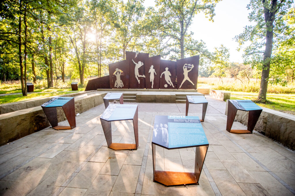
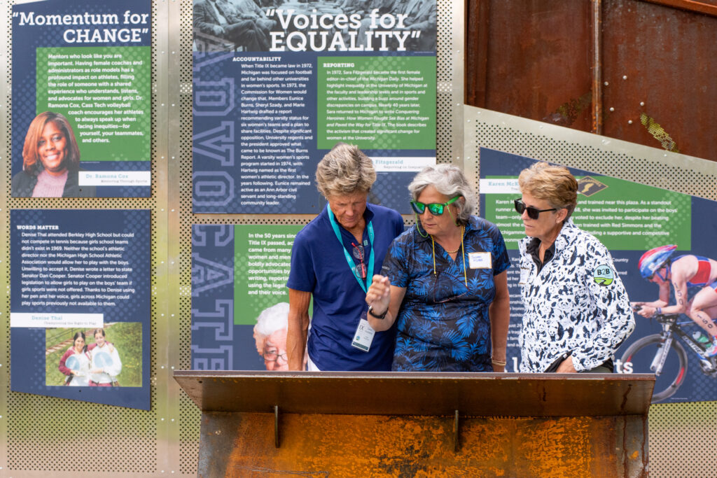
Title IX Plaza
The Title IX Plaza: A Women in Sport Journey officially opened to the public in late-August 2024. Located along the B2B Trail in Dexter-Huron Metropark, the Title IX Plaza is a joint project between the Huron Waterloo Pathways Initiative and Washtenaw County Parks and Recreation Commission. This project honors the impact of Title IX legislation on women’s sports in southeast Michigan and was inspired by the late Karen McKeachie. Construction began spring 2024 and the site opened with a celebration attended by project contributors, donors, local officials, women featured in the plaza, and the family of Karen McKeachie.

Zeeb-Delhi
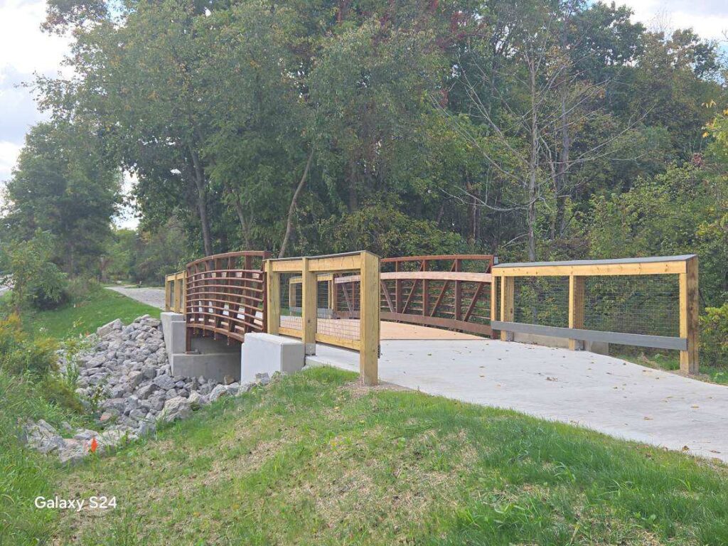
Construction on the connection from Zeeb Road to Delhi Metropark is now complete. Trail. The bridge was installed in July 2024 and it was open for use with a ribbon cutting event in early August and a community bike ride event in early October. This project adds 1.3 miles of trail extending from Zeeb Road to East Delhi Road and includes the fourth B2B Trail bridge over the Huron River. This project completes a total of 4.6 miles of continuous trail east of Dexter toward Ann Arbor and connects all three Metroparks within Washtenaw County!
Delhi to Timberwood
The next segment of this corridor is nearing complete design and is being reviewed by permitting agencies. The project team hopes to start construction in 2026. The project will include two bridges over the Huron River and 1.1 miles of new trail.
Maple Foster to Barton Nature Area
The project team continues to coordinate with MDOT and Amtrak to ensure that the project can be completed in the coming years. Public engagement on the trail projects is anticipated in the winter/spring of 2025.
ANN ARBOR CORRIDOR
Temporary Trail Closure:
The Border to Border Trail between Gallup Park and Parker Mill is temporarily closed for construction from June 30 – Mid-July 2026.
Project Improvements: Removal of the existing boardwalk due to wood rot and deterioration. Construction of a new concrete trail on a safer alignment outside the wetland area
Detour Posted: Please follow the detour route shown on the map.
Why This Work Is Needed: The existing boardwalk has begun to fail and presents a safety concern for trail users.
Thank you for your patience as we improve the trail for long-term safety and enjoyment.
The Trail Phase of the project started in March 2024 and is complete as of August 2024. This occurred along the edges of the existing trail and also in the location of the planned pedestrian tunnel. There may be temporary closures of other trails as needed during the next phases of construction.
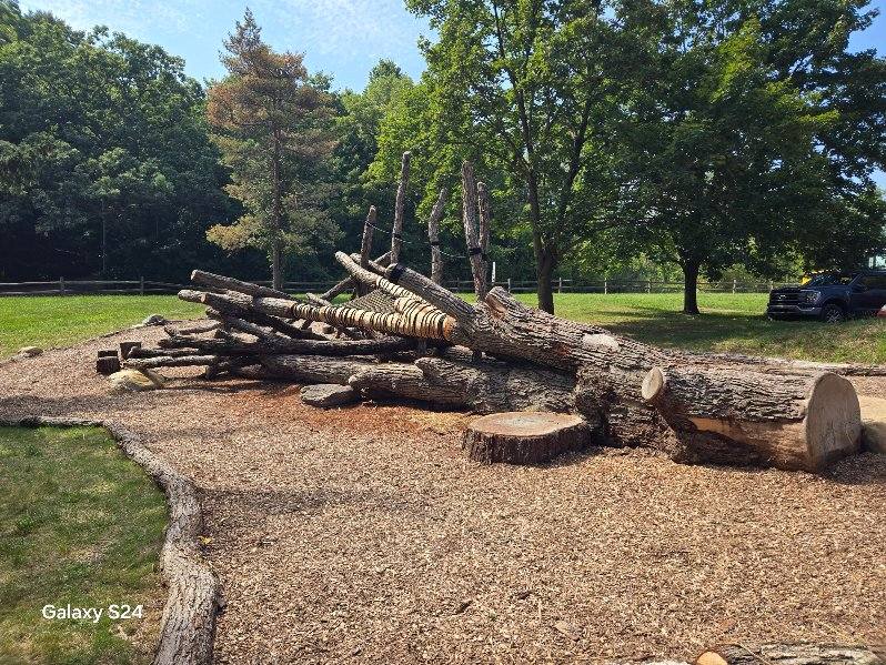
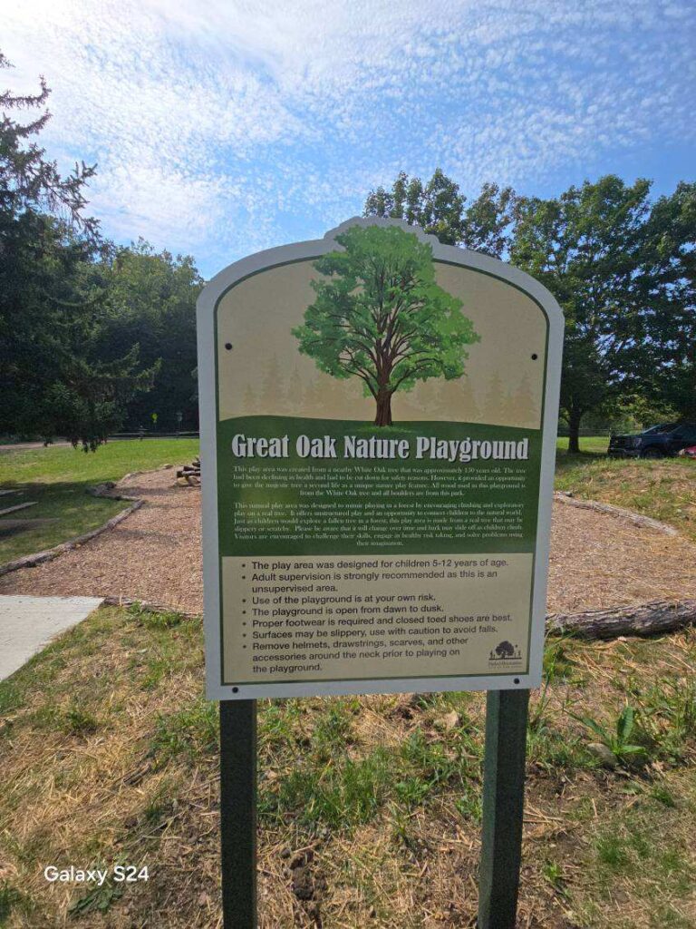
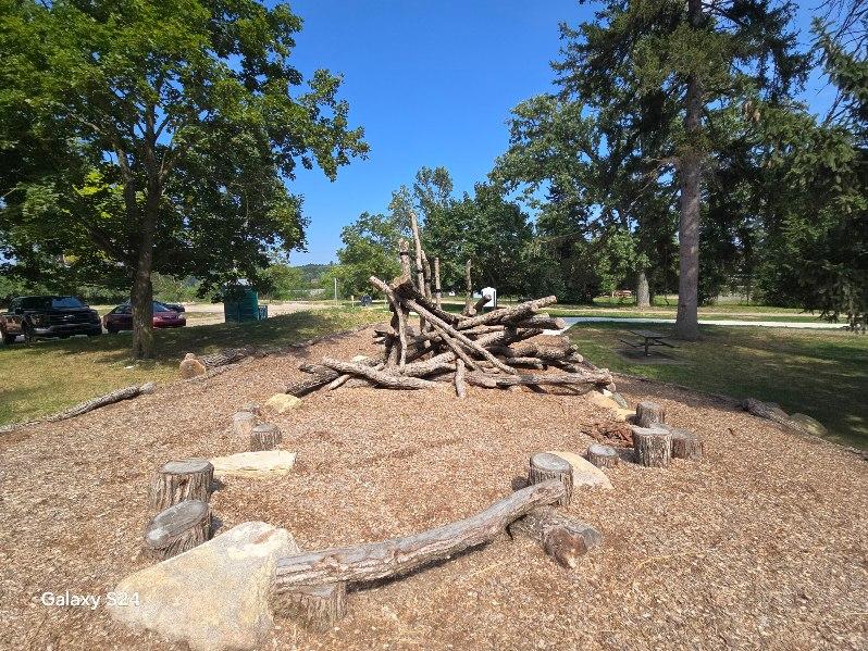
In conjunction with this project is the natural play space near the trail. This new nature playground, the “Great Oak Nature Playground,” is also now open adjacent to the parking lot near Barton Dam. The trail project required the removal of a dying and potentially hazardous white oak tree. The dying tree is estimated to have been more than 150 years old and was felled in a way that allowed it to be reused on site as a new nature play structure. To learn more, read up on the City of Ann Arbor’s projects happening in this area on their website.
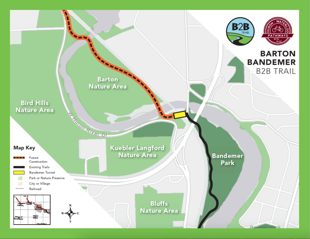
We’re excited for continued progress on the Barton-Bandemer Pedestrian Tunnel—a key connection under the railroad that will link Bandemer Park to Huron River Drive and the Barton Nature Area along the B2B Trail on Ann Arbor’s northwest side.
On March 24, 2025, the City of Ann Arbor broke ground on the tunnel that will pass beneath the MDOT railroad operated by Amtrak. From June 3–5, crews took advantage of a scheduled train service pause to complete a 48-hour, round-the-clock operation to install the main tunnel structure.
The city is partnering with Washtenaw County Parks and Recreation Commission and the county’s non-profit partner, Huron Waterloo Pathways Initiative (HWPI), on this project to extend the B2B Trail westward through Barton Nature Area. The pedestrian tunnel will connect the new segment of the B2B Trail in Barton Nature Area — which was completed in summer 2024 — with the existing B2B Trail network in Bandemer Park and more than 20 miles to the east.
We anticipate completion in November of 2025. Check out the City of Ann Arbor’s project website for the most updated project information and trail access restrictions in place for the duration of the project.
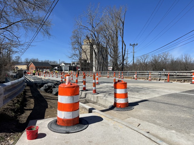
Gallup Park bridge: Crews poured concrete pathways leading up to the Gallup Bridge near the B2B Trail. The new vehicle and pedestrian bridge is based on input from the community and will maintain a single vehicle lane and expand the sidewalks on either side to improve safety at the interface with the bridge. This project also includes improvements to the park road approaches, Border to Border Trail crossing, and park pathways. Learn more about this City of Ann Arbor project on their website. A wayfinding kiosk will be installed near this site in 2025.
YPSILANTI CORRIDOR
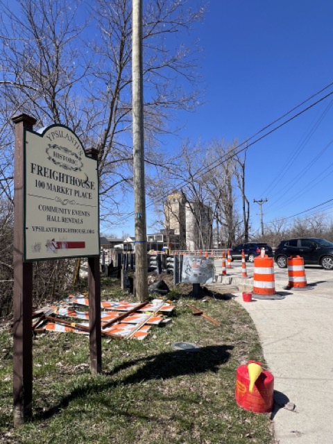
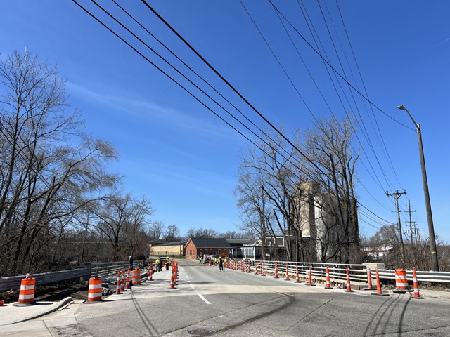
In Ypsilanti, the project team has collaborated with two City-led initiatives, enhancing small segments of the Border to Border Trail alongside adjacent road and bridge developments. Improvements have been made along Huron River Drive east of LeForge Road, and enhanced non-motorized connections have been coordinated on the Forest Avenue Bridge, located just north of Frog Island Park.
For more information on the Huron Drive project: https://cityofypsilanti.com/887/Huron-River-Drive-Roadwork
For more information on the Forest Bridge project: https://cityofypsilanti.com/892/Forest-Street-Bridge
Looking ahead within the City of Ypsilanti, enhancements to Riverside Park, such as the redevelopment of a trail segment and the expansion of the Depot Town parking lot, are anticipated in the coming years.
B2B TRAIL WAYFINDING
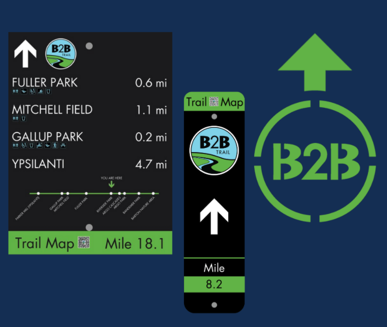
To improve the usability of the trails for residents and visitors, WCPARC is developing a series of wayfinding signs and structures to be installed across the Border to Border Trail system. Installations are planned to roll out in 2024 and continue over the next couple of seasons. Features will include:
- Primary orientation nodes will be installed at large parking access points with supporting trail amenities where people will be encouraged to park as primary access points. These structures will help to encourage sitting/resting, viewing, and further exploring before heading out on the trail. Content that will go on the primary orientation nodes will include local and regional trail maps, emergency contact information and trail etiquette guides.
- Secondary nodes – Map stations placed at highly visible spots at small parking access points, local access points, and intersecting trails.
- Directional signage will include a linear trail map with mile markers and miles to the next major destination point with amenity notes.
- Blazes will be used frequently on free-standing posts or attached to an existing post.
- Pavement markings will be used on the ground frequently where there is a turn or a choice to be made that could potentially cause users to leave the trail.
Installation of the wayfinding system will begin on the west side of the county and on newer segments of trail where there are few to no signs. The next priority is to replace the existing signs throughout the system to maintain consistency and updated accuracy. As new segments get constructed, now that the new wayfinding system is developed, signs will be part of the initial trail construction. As of fall 2024, the foundations are poured in Lyndon Twp, Timbertown, Freer Rd, Dexter Huron. There will also be one in Lowertown, another in Gallup Park, the Barton Bandemer Pedestrian Tunnel, and Frog Island in Ypsilanti.
CONNECTING TRAIL UPDATES
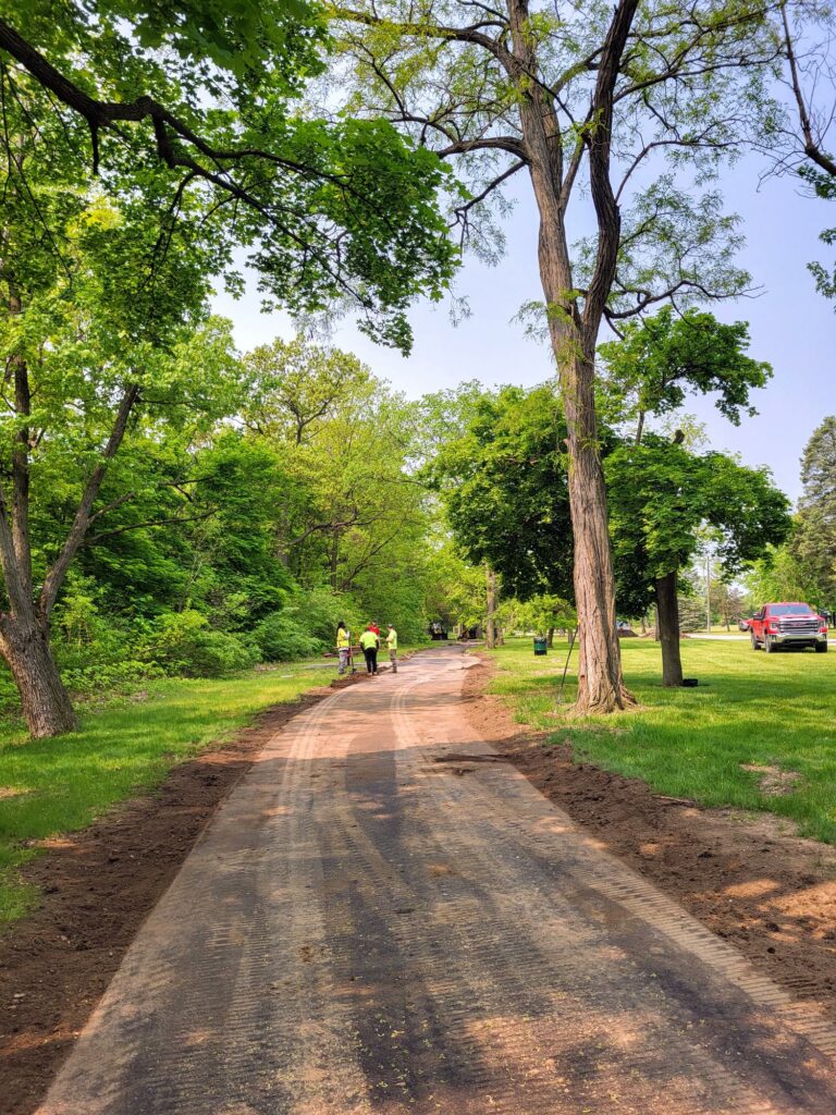
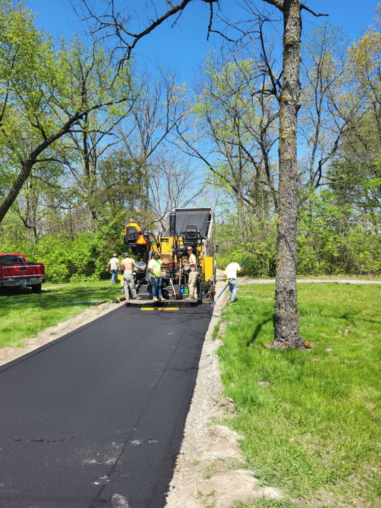
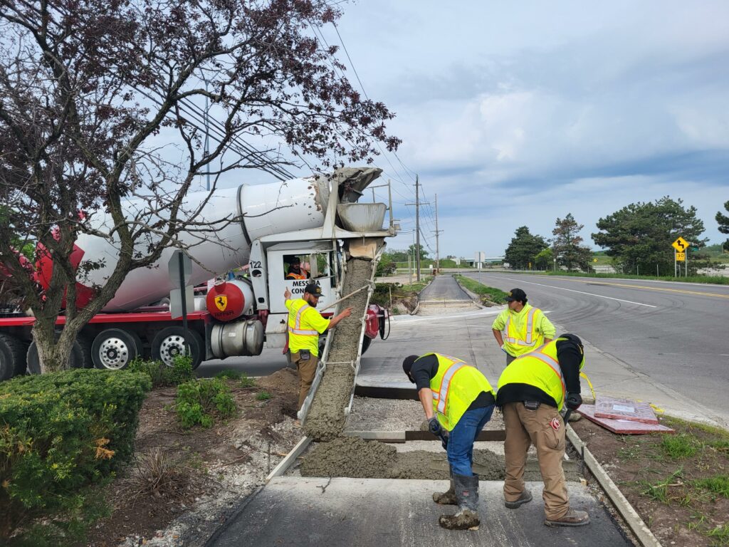
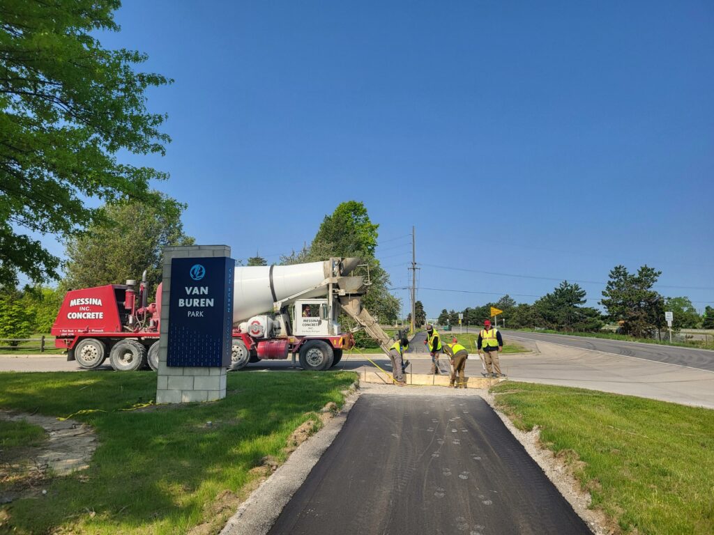
Iron Belle Trail – Van Buren Township
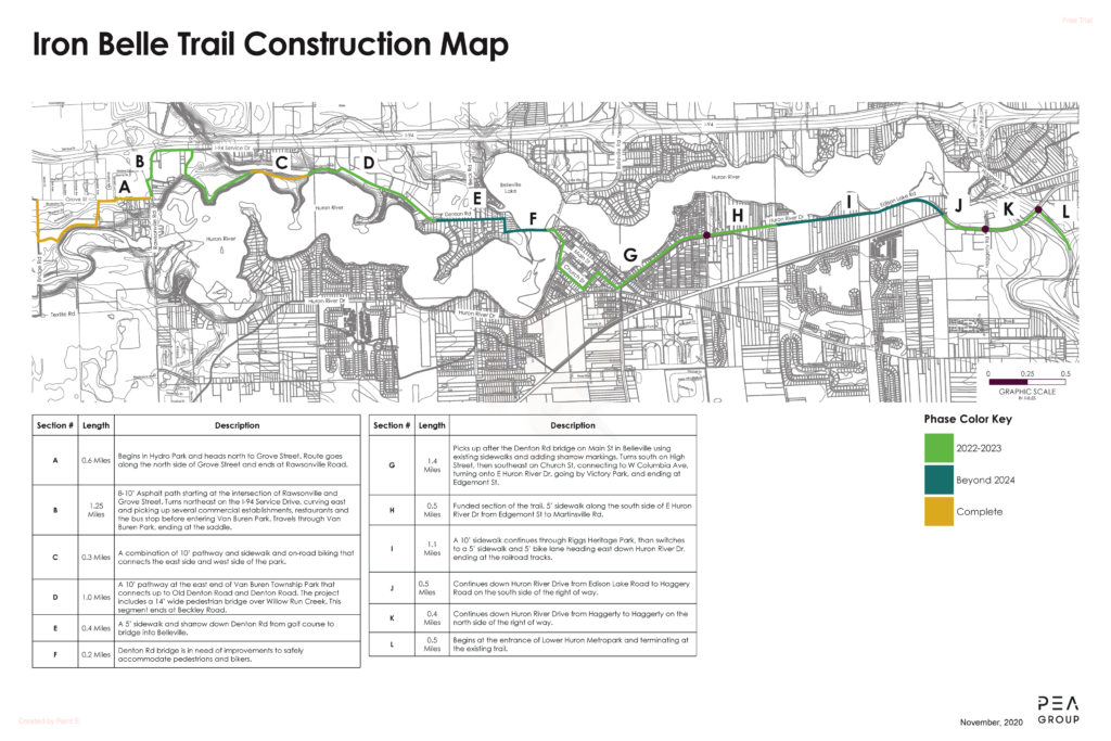
- Segment B – Rawsonville Rd through Van Buren Park
- Description: A 1.25 mile segment that began in fall 2022 is complete.
- Van Buren Township hosted a ribbon cutting celebration in October to mark the opening of this trail segment. The DTE Foundation created a video for the occasion – DTE Foundation Helps To Open Iron Belle Trail
- Segments J and K – Huron River Dr. to Lower Huron Metropark
- Description: Construction along this 0.9-mile segment has begun and are complete September 2024 after planting 50+ trees.
- Segment D – Van Buren Park to Denton Road and Beckly Road.
- Description: Out for bid opening in October with construction in early winter with completion in summer 2025.
Overall, the Van Buren Trail should be nearly 50% complete by the end of 2024.
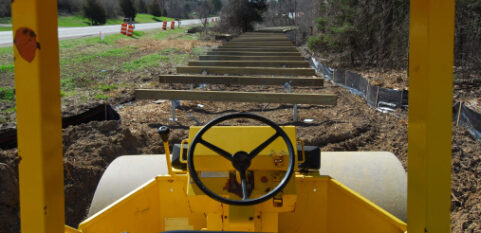
Photos below show progress on Van Buren Trail Segment B.